DC0300s-MC-019
Item
-
Title
-
DC0300s-MC-019
-
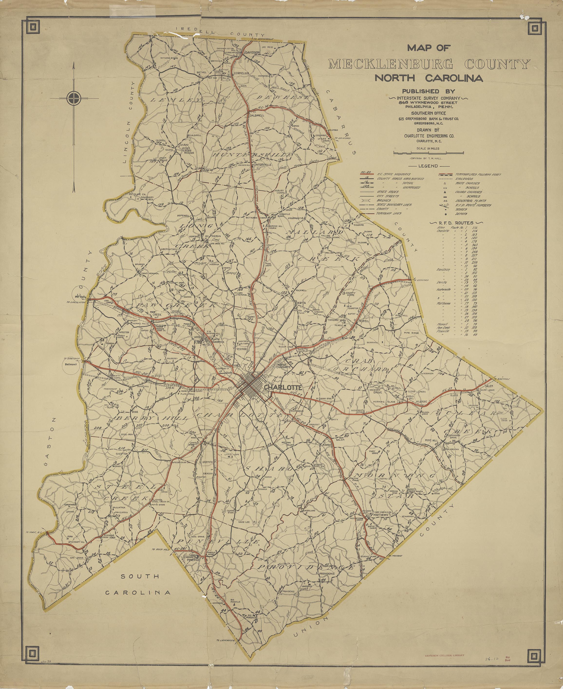
Map of Mecklenburg County, North Carolina
-
Description
-
Road map of Mecklenburg County, NC showing township lines, white churches and schools, black churches and schools, RFD routes and industrial plants.
-
Contributor
-
Charlotte Engineering Company
-
T. M. Hall
-
Coverage
-
4049696
-
Creator
-
Interstate Survey Company
-
Date
-
January 1929
-
Format
-
jpg/1 MB
-
Identifier
-
DC0300s-MC-019
-
Language
-
English
-
Publisher
-
Davidson College
-
Rights
-
For permission to reproduce image, contact archive@davidson.edu
-
Subject
-
North Carolina -- Mecklenburg County
-
Type
-
Image
-
Original Format
-
Paper
-
Extent
-
38" x 33"

 DCO_300S_Meck-19_001.jpg